Goals:
- To form in students an idea of the surface of their native land.
- Learn to work with a map.
- To develop children’s cognitive activity, observation, ability to analyze and draw conclusions.
Equipment: physical map of the region, photographs of ravines, quarries, landfills.
During the classes
1. Organizational moment, communication of the topic and goals of the lesson
The sun is shining over Russia,
And the rains rustle over it.
In the whole world, in the whole world
There is no country closer to her!
Why are there no native countries in the whole world? ( Russia is our Motherland, the country in which we live. This is our home, which is impossible not to love )
Today I invite you on a journey through our native land. We will cover the territory of our region from east to west and from north to south.
2. Working on a new topic
We have a companion with whom we will travel.
Find out!
good, good,
He looks at all the people
And to people for themselves
Doesn't tell me to look.
(Sun )
Of course it's the sun! It will travel with us around our country, or rather, we will be its companions.
Let's begin our journey.
(The Sun is fixed over the East European Plain).
Where are we now? What can you tell by studying the map?
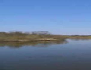
(We stopped at the East European Plain. It is a plain because on the map it is depicted in light green. And there are yellow spots on it, like patches).
Let's try to unlock the secret of yellow spots (view slides).
What special thing did you notice about the topography of this plain? (Here the surface is uneven, there are hills)
So what is the secret of yellow spots? (These are hills).
Yes. These are highlands and hills, which is why this plain is called "hilly plain".
And now we are on our way to the capital of our Motherland. (The sun is fixed over Moscow).
In the European part of Russia, between the Oka and Volga rivers, we see a bright circle - this is how the capital of Russia, Moscow, is designated. The Moscow region is located around Moscow. Its borders are shown in yellow.
The Moscow region is located very conveniently - in the center of land and river roads that run from north to south and from west to east. Moscow is not only the capital of Russia, but also the main city, the regional center of the Moscow region.
The Moscow region covers an area of 4,700 square kilometers. This is more than the territory of such European states as Belgium, Denmark or Holland. The Moscow region borders seven regions.
Guys, look at the map of the Moscow region, show and name these seven regions. ( Yaroslavl, Vladimir, Ryazan, Tula, Kaluga, Smolensk, Tver regions).
Guys, look at the map and determine what surface forms there are in the region, what they are called.
(The sun is fixed in the northwestern part of the Moscow region).
Children:
The surface of the Moscow region is mostly flat and is part of the East European Hilly Plain. The highest, hilly part of the Moscow region is the northwestern and western. Here is Smolensk-Moscow what a hilly plain, upland. On this hill, the hills seem to form a chain, a ridge. On On the territory of the Moscow region, this ridge is called Klinsko-Dmitrovskaya.
Guys, I want to add.
Indeed, the Moscow region is located in the center of the East European Plain. The north of the region is occupied by the swampy Upper Volga Lowland. To the south of it is the hilly Smolensk-Moscow Upland. Here, near the town of Uvarovka is located highest point of the region (310 m above sea level). The northwestern edge of this hill is known as the Klinsko-Dmitrovskaya ridge. Rivers that originate north of it flow into the Volga, and those that begin to the south flow into the Oka (with the exception of Yakhroma).
Guys, where is our sun located? (Our sunshine located in the south of our region).
Using the height scale, determine which surface shapes are to the south. What are their names?
Children:
The southwestern and southern parts of the region are occupied by the slightly hilly Moskvoretsko-Oka Plain, on which a small hill stands out - Teplostanskaya.
You said that the southwestern part of the Moscow region is occupied by the Moskvoretsko-Oka Plain. It includes the Teplostanskaya Upland, on which it is located the highest point in Moscow is 253 m.
Guys, is our sun located?( in the north east). What is the surface like in this area of the region?
Children:
The north and east of the region are occupied by flat plains. In the east, this plain is very swampy and is part of the Meshcherskaya lowlands, Meshchera.

The Klyazma River in Vladimirskaya Meshchera G . Cockerels
Well done boys! Everything you said is correct. I would only like to add that the Meshchera Lowland, Meshchera, is a vast plain located in the Central Federal District, occupying the eastern part of the Moscow region, the southern part of the Vladimir region and the northern part of the Ryazan region. According to this, they distinguish: the Moscow Meshchera, the Vladimir Meshchera and the Ryazan Meshchera. In the north of the lowland, the altitude above sea level is 120 - 130 meters, decreasing to 80 - 100 meters in the southern part of the lowland.
In the center of the lowland from the city of Yegoryevsk to the city of Kasimov stretches a small hill composed of sands and loams - the Meshchersky ridge, its average height is about 140 m and its maximum is 171.8 m (Aryushina near the village of Savinskoye Orekhovo - Zuevsky district).
3. Physical education minute
The wind blows in our faces
The tree swayed.
The wind is quieter, quieter, quieter,
The tree is getting higher and higher.
4. Continuation of a new topic
The surface of the Moscow region is composed mainly of sand and clay. These substances are easily washed away by water. Therefore, there are many ravines throughout our region. How are ravines formed? (Children's answers).
Ravines destroy fertile lands. This causes great harm to the economy, which is why people are fighting against ravines.

Name several methods of dealing with ravines.
Paramonovsky ravine
There are a lot of ravines in our region. One ravine is located in our area, near the Klyazma River in the territory of the city of Korolev. What is the surface of Moscow like? Look at the map of Moscow ( By
Most of the surface is flat.)
Right. Most of it is flat, heavily swampy plain. Vast and especially marshy swamps occupied the entire eastern part of Moscow. On the site of modern Teatralnaya and Revolution squares there was a swamp called Pogany Brod. The territory of the modern All-Russian Exhibition Center was very swampy. Only the southern part of Moscow is a hilly Teplostanskaya plain, which turns into the Vorobyovy Gory closer to the center. But these are not real mountains, but one of the highest places in Moscow. The widespread belief that Moscow stands on seven hills is not entirely accurate. These are just elevated, steep river banks. For example, Borovitsky and Vagankovsky (the building of the Russian State Public Library is located on it - the Pashkov House) hills are located above the Moscow River, Tagansky - above the Yauza, Trekhgorny - above the Presnya River.
- 5. Consolidation
- What is a plain?
- Which plain is shown in this diagram?
- How do you feel when looking at these photographs? (I suggest looking at photographs of vacant lots and abandoned quarries).
6. Summing up
- What did we learn about in class today?
- What do we call our native land?
- Where is our region located?
- What is the surface of our area?
- What harm does the ravine bring to people?
1. Solve the crossword puzzle.
Horizontally:
2. Central Siberian... Answer: Plateau
4. An artificial mountain created by man from industrial waste. Answer: Terrikon
7. One of the natural factors that has a destructive effect on rocks and soil. Answer: Wind
8. An elevation rising above the surface of the earth to a height of more than 200 meters. Answer: Mountain
Vertically:
1. A large, flat piece of land plowed for crops. Answer: Field
3. Place of extraction of shallow minerals. Answer: Quarry
5. A large ravine formed in the soil as a result of heavy rainfall.
Answer: Ravine
6. A depression in the ground with gentle slopes covered with plants.
| Answer: Beam |
2. Fill out the table. Write in what ways you can protect and restore the surface of your native land. |
| Reasons for surface destruction | Surface restoration methods |
| Formation of ravines and gullies | To stop the formation of a ravine, small potholes are buried and grass is sown in this place. Low fences made of willow stakes and twigs are placed across a small ravine. Over time, the stakes will take root, and a reliable living barrier will form for water flows. Trees and shrubs are planted along the edges and slopes of the ravine. |
| Improper plowing of land | Plowing can only be done across slopes. And steep slopes cannot be plowed at all. |
| Landfills | Sorting and recycling of waste at special plants. Hilling, planting with plants. |
If you find a landfill, you must report it to the Nature Conservation Society. It is necessary to take part in garbage collection. Abandoned Quarries
The waste heaps are leveled, soil is brought in and plants are planted. Valuable substances are extracted from waste heap rocks.
Lesson type:
combined
Target- formation of a holistic picture of the world and awareness of man’s place in it based on the unity of rational-scientific knowledge and the child’s emotional and value-based understanding of his personal experience of communicating with people and nature;
Characteristics of student activities Understand educational objectives of the lesson, strive to fulfill them. Describe according to his observations of the shape of the earth's surface of his native land, from local history literature information about the surface of the region. Discuss measures to protect the surface of their region. Formulate conclusions from the studied material, reply to final questions and evaluate achievements in the lesson
Planned results
Subject
Know the concepts of “ravine”, “beam”.
Be able to show mountains, plains, rivers on a map, globe, distinguish between natural objects and products, objects of living and inanimate nature.
Metasubject (Regulatory. Cognitive. Communicative)
P. - construct messages orally, analyze objects highlighting essential and non-essential features.
R. - take into account the action guidelines identified by the teacher in the new educational material in collaboration with the teacher. Learn to express your guess.
K. - ask questions, seek help.
Personal results
A feeling of love for one's country, expressed in interest in its nature.
Cooperation skills in different situations, the ability to avoid creating conflicts and find a way out of controversial situations.
Basic concepts and definitions
"ravine", "beam".
Preparing to learn new material
Based on your observations, as well as using a map of the region and local history literature, describe the main forms of the earth's surface in your region. Don't forget that plains can be flat or hilly, and mountains can be of different heights.
Learning new material
You already know that on the plains there are ravines. They have steep, crumbling slopes. There are usually almost no plants on the slopes of ravines
The formation of a ravine begins with a small pothole on the surface of the soil. Streams of melt and rainwater erode it, and therefore the ravine gradually increases in size. At the same time, it destroys large areas of fertile soil.
Over time (after many years), the slopes of the ravine become gentle, overgrown with grass, shrubs, and trees. The ravine stops growing. So he turns into beam. A beam is a depression with gentle slopes covered with plants.
If you saw a ravine during the excursion, tell us about it. Are there many ravines in your area? Are there beams in your area? Tell us about the one you saw on the excursion.
Comprehension and understanding of acquired knowledge
Think about where it is easier to build cities, villages, lay roads, cultivate the land - on the plain or in the mountains. How do people use the surface in your region?
DO YOU NEED TO PROTECT... THE SURFACE?
This question may seem strange. It is necessary to protect plants, animals, purity of air and water. And what about the surface of the edge?.. Is there any threat to it? Let's speculate.
During your excursions, you probably noticed the beauty of the surrounding area. How do you feel when you go out into an open place where you can see far away? You probably feel joy and pride for your native land. How beautiful she is!
But it also happens that instead of these feelings you experience bitterness and resentment. For example, at an abandoned quarry. Once upon a time, sand, clay or coal were mined here. Now the quarry is a wound on the surface of the earth. But people had to fill it up and plant a forest in this place or turn the quarry into a fish pond.
And in another place, builders erected new houses and left a large landfill. There are broken bricks, shards of glass, and much more. The people who worked at this construction site violated the law, which prohibits throwing out garbage anywhere. And how many such landfills disfigure the surface of our earth!


A tractor driver is not acting like a business owner if he plows the ground on a slope so that the furrows go down along the slope. After the first rain, streams of water will flow along these furrows - this is the beginning of the ravine! Plowing can only be done across slopes. And steep slopes cannot be plowed at all.
To stop the formation of a ravine, small potholes are dug in and grass is sown in this place. Across a small ravine there are low fences made of willow stakes and twigs. Over time, the stakes will take root, and a reliable living barrier will form for water flows. Trees and bushes are planted along the edges and slopes of the ravine.


Correct and incorrect plowing of slopes
You too can participate in protecting the surface of your region. Explore the surroundings of the city and village together with adults. If you find an abandoned quarry, an illegal dump, plowing along the slopes, or a pothole that can turn into a ravine, report it to the Nature Conservation Society. Take part in garbage collection, in the fight against ravines
So it turns out that the earth’s surface must be protected no less carefully than water and air, plants and animals.
Let's discuss!
What cases do you know of people’s irresponsible attitude towards the surface of their region? Is it possible to compensate for the damage caused to nature in these cases? How to do it?
Independent application of knowledge
check yourself
1.Tell me about the surface of your edge. 2. How is the surface used in your area? 3. What does it mean to “protect the surface”? 4. How can schoolchildren take part in protecting the surface of their region?
Mountains that shouldn't exist
In some areas of our country, where many minerals are extracted from the depths of the earth, mountains have grown - waste heaps. They did not grow by themselves, people poured them in. When extracting minerals and processing them, they dumped all the waste - waste rock - into heaps. The heaps grew and grew... And it turned out that people, living on the plain, ended up... in the mountains.
Terricons are not at all harmless. After all, under them were huge areas of fertile land, taken away from agriculture. The waste heaps themselves spread clouds of dust around themselves, which pollutes the air. It happens that waste heaps catch fire, spreading acrid smoke. And the polluted water flowing from them after rains poisons the soil and water bodies.
People are fighting waste heaps. Somewhere they are leveled, soil is brought in and plants are planted. In some places they have learned to extract valuable substances from waste heap rock. So the mountains created by people are gradually disappearing.
Yes, these mountains did not exist before. We must try very hard to ensure that they do not remain in the future.

Terricons
Conclusion
When doing housework, people use... the top of its edge. This must be done carefully so as not to disturb the beauty of our native land and to prevent the formation of ravines and illegal landfills.
Homework assignments
1.Write in the dictionary: ravine, beam.
2.Draw what the surface of your edge looks like. You can sculpt a model of some part of it (hill, ravine, mountain range) from plasticine, clay or raw sand.
3. If there is a ravine in your area, ask adults how long it has existed, how it has changed during this time, what people are doing to stop its growth. Think about how you can help adults.
Kirov: SecretsEarthVyatskaya
Vyatskieravines
Razderikhinskyravine
hidden treasuresVyatki - Podchurshinskoyefortification
AncientsdumpsAndwaste heapsBashkiria
Is Planet Earth a giant mined out quarry?
Information sources:
A. A. Pleshakov textbook, workbook The world around us, grade 3 Moscow
"Enlightenment" 2014
Presentation hosting the world
To use presentation previews, create a Google account and log in to it: https://accounts.google.com
Slide captions:
The surface of our region is grade 4
Relief A convex image on a plane. The structure of the earth's surface.
The surface is flat. When you are outside a city or village, you see the terrain around you. The terrain surface varies. In some places there are neither large elevations nor deep depressions. Such a surface is called flat or plain. In some plains, increases can be observed. These are hills. A plain that has hills on it is called a hilly plain.
flat plain
Ravine There are ravines on both hilly and flat plains. Often ravines have steep, sheer slopes, stretch for several kilometers in length, reaching a width and depth of several tens of meters. Streams often flow along the bottom of ravines. After heavy rainfalls and melting snow, the streams become turbulent, fast and erode the ravine even more. So the ravine grows in breadth and depth.
Image of a plain on a map Plains on maps are depicted in green and yellow. On the territory of Russia there are two plains: East European and West Siberian.
The surface is mountainous. The peaks of high mountains are often covered with eternal ice sparkling in the sun - glaciers. Often glaciers have a bizarre shape: sometimes like a hat with earflaps placed on the head of a giant rock; then like a spreading tree, stretching its icy branches to the side from the trunk. The slopes of such mountains can be steep and precipitous, and individual rocks seem to be about to break off and fly down, carrying everything with them. But often the slopes of such mountains are covered with lush forests.
Types of mountains There are low mountains with almost no glaciers. Usually different plants grow on their slopes and tops. Often in the mountains there are only bare rocks or rocky places. Mountain rivers and streams are stormy and swift. Beautiful lakes in the mountains. They are small in size, but often very deep, with crystal clear water.
Image on the map Mountains are depicted in brown on maps. The higher the mountains, the darker their color on the map. On the territory of Russia there are the Caucasus Mountains, the Ural Mountains, and Altai.
Plains and mountains in human life Man uses different forms of surface in different ways. On the plains, people plow the land, sow grain, plant vegetables, and plant gardens. Part of the plains is occupied by meadows and pastures. Cattle are grazed on pastures and hay is harvested in meadows. Vast areas of the plains are covered with forests. Timber is harvested in the forests. It is convenient to build roads, cities, and towns on the plains.
Pasture on the plain
Plains and mountains in human life Mountains are less suitable for human use. But even here, especially in the valleys, people grow various plants, and where there are good meadows, they graze domestic animals. It is difficult to build roads in the mountains: steep slopes, deep gorges, and cliffs get in the way. Highway roads are usually narrow. There may be a mountain on one side of the road, and a cliff on the other. Roads in the mountains are dangerous for traffic. Here, high skill is required from drivers. Railways are built in valleys. Tunnels are built for them in the mountains themselves.
Plains and mountains are a wonderful place to relax. There are many sanatoriums, holiday homes, and tourist centers on the plains and mountains. Holidays in the mountains, especially in summer and winter. Attracts a lot of people. Mountains attract with their amazing beauty and unusualness.